New Orleans Study for Bayou Sauvage Urban National Wildlife Refuge
The Regional Planning Commission (RPC), in collaboration with the City of New Orleans (CNO), received a grant to develop an Access Improvements Plan for the Bayou Sauvage Urban National Wildlife Refuge (NWR), under the 2022 Louisiana Federal Lands Access Program (FLAP).
Project Background
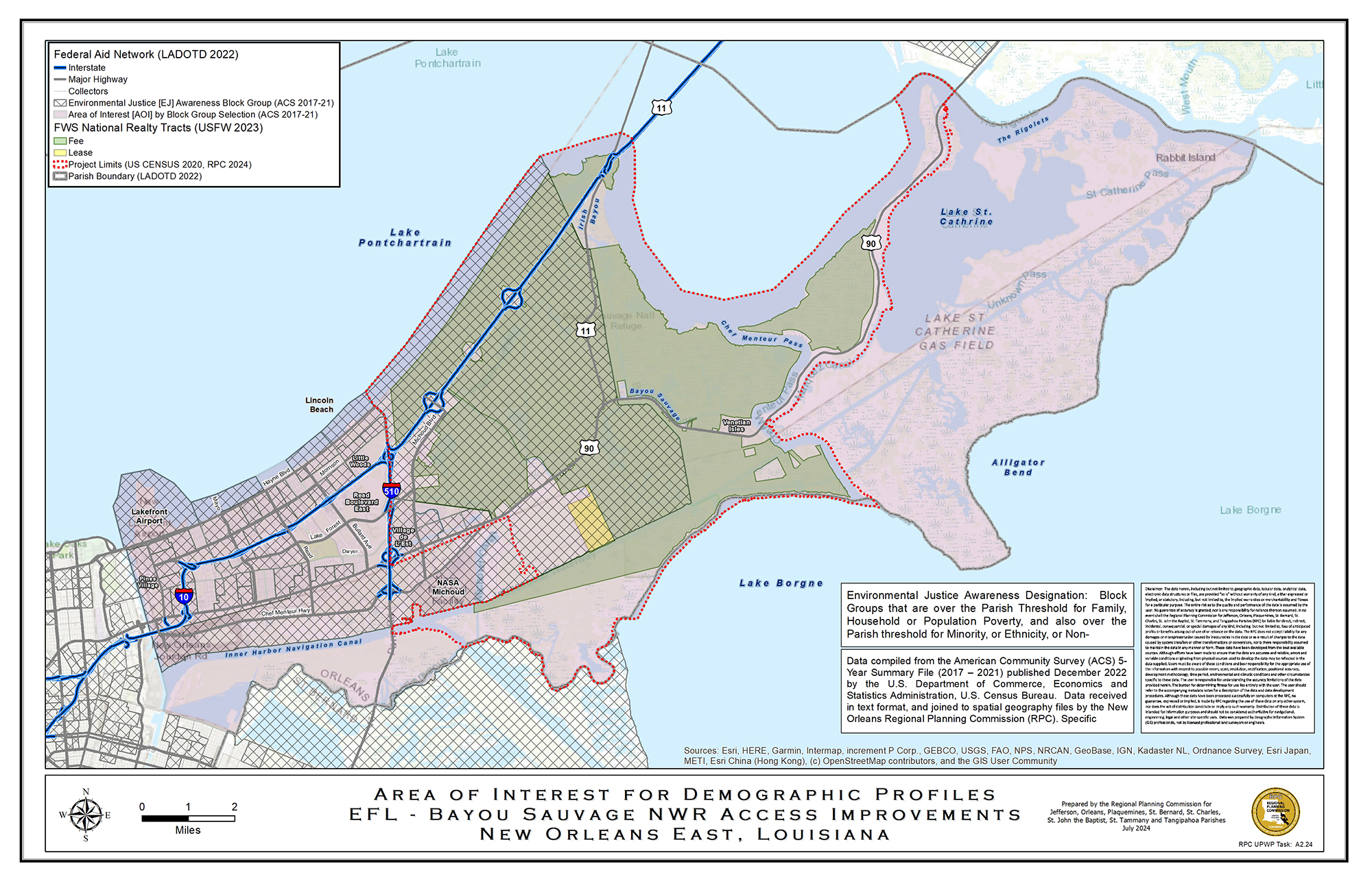
Bayou Sauvage, the second largest urban wildlife refuge in the U.S., spans over 27,000 acres of wetlands in Orleans Parish and attracts around 270,000 visitors annually. It offers wildlife habitats, particularly for migratory birds, and recreational opportunities such as paddling and fishing. However, access is limited off major roads in very view locations. Most of the refuge can only be reached by boat due to a lack of developed trails and facilities, limiting non-motorized access.
Project Purpose and Need
The project aims to create a comprehensive transportation plan to enhance recreational access, focusing on non-motorized facilities. The study will address physical and jurisdictional challenges to improve visitor access, especially from nearby residential areas and public roads. The plan seeks to improve multimodal access to the communities around Lake Pontchartrain, including walking, hiking, canoeing, kayaking, and bicycling. It also aims to improve recreational activities, economic opportunities, wildlife habitat, climate resilience, and provide cultural history information. The initiative aligns with local and regional transportation and recreation goals, including the City of New Orleans Bikeway Blueprint and regional trail networks around Lake Pontchartrain.